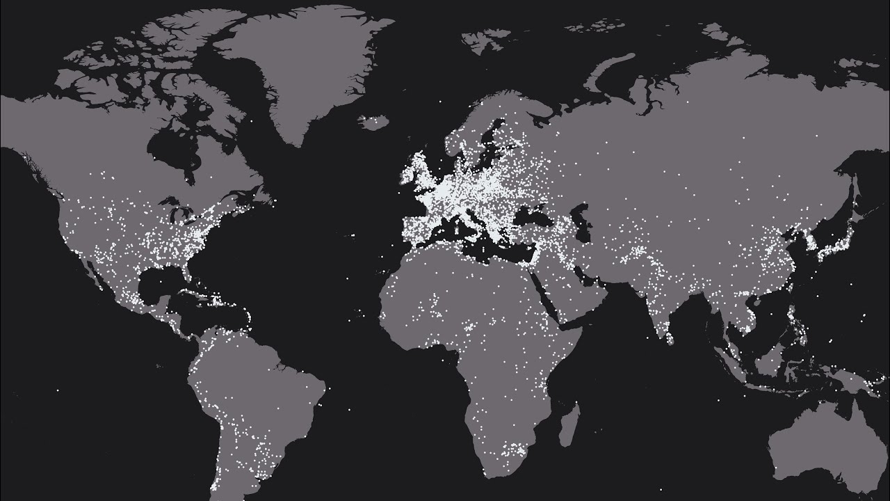
The white dots show the place of the battles. Honestly, this is amazing and really cool.
One small mistake the world image with battles made was that they’re missing the battle when
i was taking a huge (bleep) in the toilet after i ate taco bell.
4 Likes
First things first, this map is missing New Zealand, all of the Pacific, and the bottom portion of South America. I guess the Battles of Midway and the Falklands Islands among others are not important enough.
Besides being badly cropped, I have a hunch that there should have significantly been more battles in Africa and China. Also, no battles in Australia???
Apparently, this image has been reposted with 24k likes on Reddit, with the title of that post claiming that this world map has every battle recorded on Wikipedia from the last 4.5k years. But what version of Wikipedia was this (from what time and in which language)? How did they query every battle in Wikipedia?
EDIT
I originally made this post with links to Wikipedia and Reddit, but apparently posts with external links need moderator approval now. This forum has no automod and I have no reference to assess the punctuality of this forum’s mods. (Though, I presume that Texdja nor Rofle are particularly active.)
3 Likes
it seems like you can make out the borders for certain countries. mainly brazil, canada, and the arabian peninsula countries, it seems like the areas with the least wars are the places with alot of harsh uninhabitable land (canada, greenland, brazil, russia, australia).
i think you know this, but this is pretty common with maps in general. though its not usually this bad.
1 Like
I didn’t screenshot it - i downloaded the map.
2 Likes
This topic was automatically closed 240 days after the last reply. New replies are no longer allowed.